Mauna Loa summit via Ainapo Trail ascent -- Patrick Rorie
THE INSPIRATION
Having witnessed footage last year on the Discovery channel of a competition dubbed "The Eco-challenge", an intense combination of activities including nocturnal mountain climbing and paddling through rough seas, I was inspired to participate in something similar here in Hawaii.
THE CHALLENGE
On Thursday, March 18,1999, I received an e-mail message with the subject "wanna challenge?" from Gene Robinson inquiring about my availability in late April/early May for a backpack trip up Mauna Loa (lit. "long mountain" and the largest volcano in the world) via the Ainapo (lit. "dark land") Trail. I didn't know much about Ainapo, but as Gene filled in the details my desire to conquer the route only increased.
THE AINAPO TRAIL - A BRIEF HISTORY
"During the past two centuries several trails have been used to ascend to Mauna Loa's summit. The oldest, now known as the Ainapo Trail, extended 34 miles from the old village of Kapapala at 2000 feet elevation, up the shortest and steepest flank to the southeast edge of Mokuaweoweo. This trail was used in 1794 by Archibald Menzies of the Vancouver Expedition to make the first successful ascent by a non-Hawaiian.
These earlier routes fell into disuse after 1915, when a segregated company of black soldiers of the United States Army constructed the Mauna Loa Trail, which stretched from the present location of Volcano House up to and along the northeast rift to the summit caldera. Lower portions of the trail were widened and improved for vehicles, and in 1936 the CCC built the last increment of the road from Bird Park to near the site of Camp Bates at 6,650 feet elevation. The road has since been paved, and most hikers start their trip at the upper end of this road."*
THE STORY
Part 1 - "Taking Care of the Logistics"
On Friday, April 30, Gene's girlfriend Julia dropped us off at Honolulu International Airport and we caught the Aloha Air 12:15 p.m. flight to the Big Island of Hawaii. Upon landing in Hilo, Gene's backpack, an external frame pack, didn't arrive (we just barely got on the plane in time) so rather than wait for the next plane to arrive (after 2 p.m.) we picked up the rental car and headed for Walmart to purchase propane and other last minute items. It was a nice day in Hilo with puffy white cumulous clouds filling the blue sky and bright sunshine.
As we approached the entrance to Walmart I noticed a man with only one leg. Gene commented,"Whoa! That's the second one legged man I've seen today! Bad omen?". If Wing Ng had been with us he surely would have promptly returned to Oahu! :)
After returning to the airport and securing Gene's pack, the two of us drove from Hilo to Hawaii Volcanoes National Park (HVNP). Along the way we passed through the village of Kurtistown (that's Kurtistown with a 'K'!). When Gene and I stopped at the HVNP fee collection booth I thought about claiming Hawaiian ancestry thus saving the $10 entry fee. If the Ranger gave me a hard time I would simply state that I was a rare albino Hawaiian named Paka. For some reason and probably for the best, the idea never came to fruition!
Arrived at the Kilauea Visitor Center (elev. 3,974 ft) at 3:05 p.m. and commenced the permit process with Ranger Jay Robinson (same last name as Gene, a good omen!). During the thirty minute procedure, Gene mentioned that we would be ascending the Ainapo Trail. Almost immediately, Jay's facial expression changed to one of bewilderment. The Ranger then began eye balling our shoulders and chests as if conducting some sort of crude physical evaluation to ascertain our skill level. Gene also asked if he could use sticky red tape he had purchased from Walmart to mark some of the more confusing sections of the trail. Jay replied, "Absolutely not! Its against the law. What if it blows off? It could lead future hikers astray!". Not one to argue, Gene accepted the rebuke and patiently completed the forms needed to obtain the backcountry permit.
From the visitor center, the two of us traveled to nearby Volcano House and checked into a standard ground floor room in the Ohia Wing ($85.00 a night). We sorted through our stuff to decide what to store in the car then, at 4:30 p.m., drove 14 miles to the Mauna Loa lookout at the top (end) of Mauna Loa Road (elev. 6,662 ft) to leave the vehicle for our get away upon exiting the mountain.
A few minutes after 5 p.m. Gene and I began jogging down Mauna Loa Road. The lovely koa-ohia forest and almost continuous conversation made the miles fly by. Gene, an avid runner (the 1980 Boston Marathon among his accomplishments), glided along with ease like a gazel in the African plains. While exhibiting good form, I struggled to keep pace due mainly to my hiking boots (I had forgotten to bring running shoes). Once we had gone ten miles and reached Rte 11, I started to run out of gas. We shaved off half a mile by cutting through the Kilauea Military Camp (KMC), passed by a few active steam vents, veered onto the wide Halemaumau Trail and stopped for a breather at the Kilauea Caldera overlook.
Pressing on, Gene and I accomplished the final stretch to the Kilauea Visitor Center as darkness set in arriving there at 7 p.m. We hydrated using the water fountain then studied the miniature model of Mauna Loa. At 7:06 p.m. the two of us approached Volcano House, entered the Ohia Wing and took showers. Fulfilled 8 p.m. dinner reservations enjoying delicious meals inside the rustic Volcano House Restaurant. I consumed friend chicken ($9.90) while Gene dined on linguine, and we both ordered a bowl of clam chowder ($4.50 per serving).
After dinner I relaxed briefly in the Ohia Wing lounge complete with two chairs and a couch each covered with dark red satin, a fire burning in the fireplace. Entered our room and found Gene carefully organizing his pack for the next day's journey. I made some adjustments to my gear as well. Before hitting the sack, Gene (a medical doctor) gave each of us half a tablet of diamox to help our bodies cope with high altitude. Lights out came at 11:11 p.m.
Part 2 - "A Leisurely Stroll to the Halewai Cabin"
Arose at 6 a.m. on Satuday, May 1 (lei day), to the sound of my watch alarm. Stumbled into the bathroom to shave and brush teeth, my right calf extremely sore from the run the previous afternoon. Gene and I switched places and I changed into hiking attire as well as stuffed my Kelty backpack to almost overflowing. At 6:34 a.m. Gene gave me another half pill of diamox which I downed with some tang.
By 7:07 a.m. the two of us were packed and ready to go and departed the Ohia Wing lounge of Volcano House. Overcast skies and a chill in the air greeted us as we tramped down to Rte 11 (Hawaii Belt Road) hoping to hitch a ride to the start of Ainapo (lit. "darkened land" not "dark land" as I mistakenly typed in the prologue) Road 14 miles south of HVNP. About one hundred vehicles passed without stopping between 7:10 and 8:40 a.m. and I commented to Gene that we should have brought Mark Short along to help. "Mark must have used up all the hitch hiking good luck during his recent trip" I continued.
Frustrated by our inability to gain transport, Gene and I walked back to the HVNP fee collection booth to get advice from the Ranger. The wahine failed to impart any incredible wisdom but did cheer us up. Meanwhile, the clouds dispersed revealing blue sky.
Upon returning to the shoulder of Rte 11, our fortune continued to improve when a haole dude in an old, light blue four door sedan pulled over and offered us a ride at 9 a.m. Gene carried on a conversation with the man as he drove us toward Ainapo Road and found out that he had relocated to Hawaii in '77 from one of the Dakotas. Thirteen minutes later between mile markers 40 and 41 the dude pulled over and we exited the vehicle.

After retrieving our packs, Gene and I thanked him for the lift and entered an open, green, grassy, flat ranchland praire (elev. 2,600 ft). By now the day was an absolutely gorgeous one with lots of sunshine and a gentle sea breeze at our backs. At a spot on Ainapo Road near a corral, Gene stopped to take a GPS reading. While waiting, I scanned the territory ahead recognizing a large forest of silver oak with their attractive yellow flowers, Mauna Loa in the background our ultimate goal. As we tramped along the dirt road at a deliberate pace, I noticed small guava trees growing on both sides of the thoroughfare. Behind us, in the distance, various black cinder cones in the desert of lava. The road took us into the forest and eventually ohia with cherry red flowers and koa trees began appearing among the oak.
Surrounded by tall eucalyptus with cattle grazing nearby, the green Ainapo Ranch House became the first landmark we encountered at 10:30 a.m. and 3,700 ft. The aroma of the trees filled the air, and the gentle refreshing breeze and singing birds made for a very pleasant stroll.

Beyond the ranch house upslope the number of silver oak thinned replaced by native forest including tall ohia, uluhe ferns and pukiawe. Enjoyed a fairly level stretch about 1 mile in length, the imposing flanks of Mauna Loa dead ahead and much more detailed. The sound of bees buzzing in the native forest caught my ear, and I appreciated the contrast of red ohia blossoms against the deep blue sky. Gene and I startled a black cow and her calf in the level section and reached the 4,700 ft elevation mark at 11:55 a.m.
Fifteen minutes later at the top of a rise the two of us approached the Kapapala forest reserve boundary bordered by a firebreak road/fence.

We also spotted a mouflon sheep to the west. We watched it scurry away then proceeded through a gate into the forest reserve. Further ahead, the road went west for a significant distance then returned to its mauka heading. Koa trees with light green moss growing on the branches highlighted this segment.
At 1:16 p.m. (5,650 ft elevation and eight miles from the Rte 11/Ainapo Road junction) Gene and I arrived at the Ainapo trailhead and promptly sat down to have lunch.

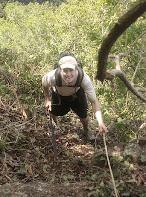
During the break clouds moved in leaving only a few small patches of blue overhead. We started up the Ainapo Trail at 1:54 p.m. and traveled over pahoehoe lava through pristine native forest with occasional sunny periods.
Note: Pahoehoe lava is the smooth, solid kind (like walking on a side walk). A'a, on the other hand, is similar to walking on a pile of rocks (unstable footing), each step shifts and it is sharp and jagged. An ankle sprain, tripping or falling are very real possibilities.
Initially, a gradual climb ensued but as we passed through a fern grotto (not uluhe) the angle of ascent increased. At 2:53 p.m. and 6,500 ft the two of us took another break. Following a gradual ascent we resumed steeper climbing, a chill in the air. Gene brought to my attention the appearance of the first "baked potatoes" (pieces of a'a lava rapped in aluminum foil used to mark the trail) atop a few of the ahu along the footpath.
Completed the three mile stretch from the trailhead to the Halewai Cabin at 3:42 p.m. (elev. 7,750 ft).

Gene and I immediately entered the shelter and removed our heavy packs. The sun came out so we returned to the outdoors and took photos of the structure. Soon after, Dr. Robinson jogged around the area to keep the lactic acid in his legs from building up. Meanwhile, I relaxed at the table on one of the stools inside the cabin.
The luxurious Halewai Shelter, constructed in March of 1994, is a small 'A' frame building equipped with a solar powered compost toilet (the solar panel is on the roof), a south facing porch, and a separate room with a small window adjacent to the porch containing the toilet. The main room (15 feet by 18 feet) has a large window facing Mauna Loa (native trees and the nearby hill block the view). Both the toilet room and main room contain a small light (twelve volt batteries supply the current). The one in the main room is located in the middle of the ceiling. Three two person bunk beds (mattresses on each bunk, sleeping bags on each mattress) and two cots are available for sleeping. The floor of the main room is green in color, the walls and ceiling white. The ceiling is ten feet above the floor and a vanity mirror (two feet long, one foot wide) leans against the wall opposite the window above hooks screwed into the wall used for hanging clothes. Also, six wooden stools are piled up neatly beside a six foot long, four foot wide table (formica top). Quality workmanship went into building the shelter, bunks, and table.
A set of five wooden steps leads to the porch and a green picnic table exists a few feet in front of the stairs, a small fire pit above the picnic table. The steps and porch are green in color while the building exterior is a shade of dark brown. A piece of wood is mounted above the porch and carved into it are the words "Ainapo Trail Shelter". Blocks of cement support the structure and the white roof is grooved. A water catchment system transports moisture from the roof to a large tan container in back of the shelter (almost full during our stay). A "chimney" originating from the toilet room juts out of the roof near the five feet long, two feet wide, five inch deep solar panal. A separate, smaller dark brown building below the cabin comes equipped with a shower and I noticed an old wooden CCC shelter covered by a rusty tin roof to the right of the lower building. On the inside of the front cover of the log book (Vol. 2) I read "The Ainapo Trail Shelter at Halewai - It is built on the site of a campsite constructed by the civilian conservation corps in the 1930's".
Once Gene returned from his run, I set out to explore the surrounding territory. Enjoyed nice views downslope and discovered a helipad. Next, I did a day hike above the cabin as the Ainapo Trail continues through old pahoehoe and native forest. After about a quarter of a mile, the terrain changes abruptly to a'a with much less vegetation. Eventually, I turned around and headed back to the shelter but I had achieved the purpose of the day hike - to get a feel for what lie ahead. Spotted two sheep upslope during the return leg and entered the cabin a few minutes beyond 6 p.m.
Between 6 and 7 p.m. dinner preparation and consumption took place. I dined on Mountain House lasagna, salad, and an apple while Gene ate Caribbean stew or beans. Both of us drank a cup of hot cocoa and I also downed a bottle of tang. The completely clear sky sponsored excellent star action that night with Orion's Belt, Venus (esp. bright), the Big Dipper, Hokulani (Hawaii's star), Spika, and Gemini dominating the heavens. Later, Gene and I experienced the best of both worlds when an awesome nearly full moon rise took place! It looked like a giant orange ball.
Gene recited a few of the interesting stories from the log book and then made an entry himself before retiring for the evening at 8:25 p.m. At 9 p.m. I penned a short paragraph describing the shelter:
"Nestled among one of Hawaii's most pristine native forests, the Halewai Shelter is one of Hawaii's best kept secrets. Described in Stuart Ball's BACKPACKERS GUIDE TO HAWAI'I as luxurious, I couldn't agree more. Very nice!"
I ventured out of the cabin into the still, cool, crisp night for the final time at 9:30 p.m., the abundant moon light illuminating the pristine native forest very beautifully as well as a thick white cloud bank on the same level as the shelter dead ahead in the distance. Flossed and brushed teeth by moon light then reentered the shelter and noticed that the temperature inside was 52 degrees fahrenheit. Reluctantly hit the sack at 10:10 p.m.
Notes:
A DLNR Na Ala Hele pamphlet states, "CULTURAL HISTORY: The Ainapo Trail, from Kapapala to Moku'aweoweo, the summit caldera, was pioneered by prehistoric Hawaiians. Probably most early ascents were made to honor Pele since no adz quarry is known to exist on or near the summit of Mauna Loa.
Archibald Menzies, the surgeon of the Vancouver expedition, is the first European known to have ascended to Moku'aweoweo. For this reason the trail is sometimes referred to as the Menzies trail. With the permission and assistance of Kamehameha, he made the ascent in February of 1794.
Until 1915, when the Mauna Loa trail was built, Ainapo trail was the preferred route to the summit. From 1870 horses and mules were used along this route. In 1913 the men of Kapapala Ranch modified it (and probably realigned portions) to create a bridle path.
In 1914, volcanologist Thomas A. Jagger, traveled the Ainapo trail to observe an eruption at the summit. His experiences on the route prompted him to lobby for construction of the Mauna Loa trail.
Since then the Ainapo trail gradually fell into disuse, portions of it becoming "lost" until Forestry and Wildlife crews reestablished the route under the auspices of the Na Ala Hele program in 1993."
During Gene's research of Ainapo, the Doctor thought that he had discovered a Chinese immigrant named Lop Sum Ng among the members of Menzies first successful ascent. Upon further scrutiny, it turned out to be false information. Sorry Wing! :-)
Part 3 - "The Tough Climb to the Summit Cabin"
On Sunday, May 2, at 6 a.m. Gene and I awoke to a new day inside the Halewai Shelter (45 degrees fahrenheit inside that morning). Upon traipsing outside, we discovered a gorgeous sight - the nearly full moon on the western horizon and the rising sun on the opposite. A beautiful arrangement of high clouds partially obscured the sun, and other than the high clouds to the east, entirely blue sky overhead.
After breakfast (including another half pill of diamox) and packing up, the two of us departed the shelter (elev. 7,750 ft) at 7:28 a.m. bound for the Mauna Loa Summit Cabin (elev. 13,250 ft). Initially, not much discussion took place as Gene led the way up the Ainapo Trail above Halewai. It was THE BIG DAY (the most difficult leg of our trip) and like warriors entering the coliseum to do battle, we had our game faces on, both of us focused on the task at hand. With plenty of time to get to the Summit Cabin, Gene laid out a simple plan - hike 1,000 feet per hour then take a brief rest to avoid any symptoms of altitude sickness.
Beyond the first quarter of a mile where the pahoehoe and most of the native forest abruptly end, I turned around while Gene took a GPS reading and spotted Kilauea Caldera downslope in the distance, steam rising out of her vent. A thick band of clouds also existed hanging slightly above the caldera stretching from north to south around the mountain as far as the eye could see. Gene and I methodically plodded along the vast dark brown 'a'a field (large ahu marking the route) climbing steadily and recognized the stark beauty of the region (a different kind of beauty), a gentle sea breeze at our backs.
At 8:43 a.m. (elev. 8,760 ft according to Gene's altimeter) we took a break. Before sitting I noticed rain coming down on the green prairie far below and clouds slowly approaching us (Kilauea Caldera now completely obscured by the thick cloud bank). I became concerned because the trail would be more difficult to follow with precipitation and/or white out. Gene's GPS told us that we were approx. 1 mile from the start of the long 'a'a section as the crow flies.

Fifteen minutes later the two of us continued our pilgrimage. With no route description available for reference (Ball's BACKPACKER'S GUIDE only contains the Mauna Loa Trail), I began to record the outstanding topographical features of the area in a notebook for future reference.
Three prominent hills appeared one hundred yards to the right (facing mauka) of the footpath, and Gene and I crossed a lava tube bridge at 8,850 ft, a collapsed section of the tube revealing a cave for possible emergency bivouac. We traversed a very short stretch of pahoehoe then returned to 'a'a. Heat rising from the lava fields was clearly visible (not due to volcanic activity) and Gene brought to my attention the existence of goat scat on the trail. Encountered another brief pahoehoe segment passing through a narrow defile between walls of pahoehoe. The footpath alternated between the two types of lava reminiscent of the way the KST switches back and forth from leeward (difficult) to windward (easier) then shifted to pahoehoe above the tree line (no more trees or other vegetation visible upslope) at 9,000 ft.
Gene and I paused briefly at 9:43 a.m. (9,310 ft) to check out a large opening in the ceiling of a lava tube, a beam of sun light partially illuminating the cave floor twenty feet below. Pressing on, the two of us ascended gradually learning to appreciate the pahoehoe and watching our steps on the 'a'a, "baked patotoes" and ahu marking the route. The abundance of blue sky and unobstructed sun made spotting the aluminum foil fairly easy.
At 10:19 a.m. and 9,760 feet we took another snack/water break. Gene consumed a balance bar and some gatoraid while I had a bagel and tang. During the recess I applied more sun screen and Gene took another GPS reading. Meanwhile, the clouds that were approaching from Ka'u appeared to dissipate as they gained altitude and I breathed a sigh of relief.
By 10:40 a.m. we were back on the trail trudging along at a steady pace, and at 9,900 ft the ahu all but disappeared. As we entered "No Man's Land", Gene and I spotted "baked potatoes" about thirty yards to the right of the footpath on nearby pahoehoe. Gene concluded that someone (DLNR?) had attempted to establish an easier route. The only problem is that the original path (also marked with "potatoes") still exists over sunken piles of 'a'a paralleling the new one and in white out conditions often leads to confusion (ambiguity).
Accomplished a short, but steep ascent to 10,360 ft where I noticed stakes pounded into lava bordering the trail, and fifty yards on the left at 10,500 ft I recognized the existance of a weather station. Because of its continuous uphill nature, Ainapo is certainly an honest trail.
Several "potatoes" were sighted on pahoehoe to the left with a lone ahu placed twenty five yards off the original route as a guide to the improved section. Two "potatoes" side by side on the original trail marked the junction. An easier footpath, no doubt, but more likely to cause confusion.
Identified another stake in lava at the end of a tough, steep ascent over loose 'a'a. Further ahead, I counted atleast a dozen "potatoes" in a line spaced about twenty yards apart marking the footpath. Observed yet another stake protruding slightly above the surface of the lava followed by a stretch of pahoehoe.
At 11:57 a.m. (10,870 ft and 1.16 miles from our previous break spot) Gene and I sat down on pahoehoe to rest again at a desolate place (nothing but acres and acres of lava surrounging us in all directions). Saddled up and continued our journey about half an hour later. The trail returned to 'a'a for a short stretch then switched back to pahoehoe. A few ahu helped distinquish the trail from the rest of the lava field and a mild, cooling breeze at our backs accompanied the now gradual climb.
Enjoyed a lengthy segment of pahoehoe marked by intermittent ahu on our way to an old abandoned CCC camp (windbreak, elev. 11,350 ft) made out of large pieces of lava with sea rations inside. Adjacent to the windbreak was an entrance to a lava tube, old rusty cans and glass bottles located five feet down littered the floor of the cave. We also ascertained a campsite ideal for a tent above the cave entrance. Large pieces of lava made up three quarters of the perimeter and a hill blocked the wind on the other side. Gene brought to my attention the remains of old sea biscuits each originally the size of a hockey puck. He also suggested that the area would make a great local for an intermediate cabin on the way to the summit cabin.
Departed the pahoehoe for more 'a'a , our feet shifting with every step. Lovely white cumulous clouds appeared upslope in the distance a few hundred feet above the horizon and were not taken as a threat.
The trail alternated again between 'a'a and pahoehoe and eventually the two of us entered "The Easter Egg Hunt" region (elev. 11,670 ft), a poorly marked, confusing section of the Ainapo Trail. Small "potatoes" spread out (hidden?) among the rolling hills ("dunes") of the broad pahoehoe flow hindered upward progress and the trail seemed to meander for no rhyme or reason. However, due to excellent visibility (unobstructed sun, mostly clear blue sky), Gene and I experienced, at most, short delays in identifying the ensuing "potatoes". We even took the time to rebuild fallen ahu blown over by high winds and make new ones as well as relocate a few of the small "potatoes" to improve the section. Gene commented that the dudes who designed this stretch of the footpath must have been smoking pakalolo!
At 1:59 p.m. (elev. 11,930 ft) the two of us took another break sitting down on pahoehoe. The surrounding "dunes" made it feel like we were on Mars. I ate an apple, drank half a liter of tang (the beverage of choice for the apollo astronauts and one thirsty backpacker on "Mars") and Gene recorded another GPS reading. Twenty four minutes later it was back to the grind.
Noticed more stakes pounded into the lava positioned along the footpath at 100 foot intervals. We endured steep climbing and I felt fatiqued but not dizzy. At 12,340 feet elevation I spotted a grey Dept. of Interior geological survey marker then, further ahead, Gene and I got side tracked briefly when we couldn't find the next "potato". Instead, we ended up hiking to what appeared to be an ahu.
The final steep ascent concluded (yee ha!) at 3:21 p.m. when we arrived at a dark red, wooden sign with "Entering Hawaii Volcanoes National Park Mauna Loa Cabin 2.9 Miles" carved into it on the ocean facing side (elev. 12,500 ft). On the opposite side the sign read "Entering Kapapala Forest Reserve Ainapo Trail Shelter 4.6 Miles", a bogus figure in Gene's opinion.
Ahu reemerged as guide posts beyond the sign toward the Mauna Loa Cabin and we were also led by more "potatoes". I noticed an increase in the wind blowing from the Ka'u direction, a chill in the air.
At 3:45 p.m. (elev. 12,770 ft) the two of us reached a rain gauge and an eveready lantern battery dump (former weather station?). A few of the rusting batteries were located inside the compartment at the top of a short white wooden structure which resembled a lifeguard stand. A pile of batteries in the shape of an ahu existed twenty yards from the stand.
Pressing on, Gene and I carefully traversed a large crevice and recognized yellow dots marking the route along with the "potatoes" and ahu. With the exception of a few ups and downs, the fairly level trail gradually ascended to the Mauna Loa Cabin.
We passed through an area featuring a lava formation (cone) on the left that looked like a huge version of Madonna's French bra (not that I'm a Madonna fan but that's what it resembled), a pu'u with twin humps (breasts). A note to the reader - Gene and I may not have been suffering from altitude sickness but we were certainly having delusions!!! I proclaimed the geological peculiarity "Pu'u O'Madonna" and paused to study it while Gene took a GPS reading.
After moving away from the formation, the two of us encountered 'a'a for a distance then tramped mainly over pahoehoe. The footpath returned to 'a'a and we noticed ahu across the lava field which marked the South Pit Trail at 4:49 p.m. (elev. 13,000 ft). Fifteen minutes later Gene and I accidentally veered off the Ainapo Trail but gained our first vista of the true summit across Mokuaweoweo (the summit crater). Observed a piece of snow covered ice inside a crack and came upon a windbreak made of lava four feet deep with four foot walls on each side.
At 5:09 p.m. we reached the crater rim and spotted the summit cabin in the distance for the first time. Careful not to get too close to the 500 foot vertical drop, the two of us recognized steam rising from vents on the far side of the crater floor, the South Pit gap on the left.
We traveled for a distance along the crater rim over plates of pahoehoe. I saw another geological survey marked on the right (elev. 13,105 ft) at 5:32 p.m. and veered that way while Gene continued straight. Dr. Robinson spotted a narrow wooden sign about fifty yards to the right. As I headed for it I had to scramble over nasty 'a'a. The sign contained the words "Ainapo Trail" and I tramped north on the footpath mostly over 'a'a using ahu to stay on track.
Suddenly, the Mauna Loa Cabin came into view! Fifty yards to the left was the set of two ahu that mark the year round watersource. During the final stretch to the Mauna Loa Cabin I walked on 'a'a and pebbles, the dirt underneath sinking with every step.

Triumphantly arrived at the Mauna Loa Cabin at 5:56 p.m. (elev. 13,250 ft). Gene, having pulled in a few minutes prior, helped me remove my heavy pack inside the cabin then we exchanged high fives! Both of us reclined at the table as Gene recited a few of the entries from the log book.
Afterward, I proceeded to the toilet to relieve myself and recognized Mauna Kea in the distance completely clear of clouds, its golf ball shaped observatories scattered about the summit. Exited the latrine, strolled over to the edge of Mokuaweoweo and shouted "Yes!" (my voice echoing throughout the crater) not as an advertisement for First Hawaiian Bank, but to express the joy of accomplishing the difficult trek up the Ainapo Trail from the Halewai Shelter.
When I returned to the summit cabin, Gene went for a quick jog and I recorded an entry in my journal. At 6:36 p.m. (55 degrees fahrenheit inside the cabin) the sun disappeared below the crater rim and I began putting on just about every piece of clothing I had brought including HTM legend John Hall's red sweat pants and shirt. John, a frequent visitor to Mauna Loa in his younger years, gave them to me as a gift, a symbolic passing of the baton.
In the storage room next to the kitchen, Gene and I discovered Randy Ching's external frame backpack. According to the permit attached to the backpack, Randy had made a sojourn to the summit cabin with a friend around New Year's. I found out on Tuesday, May 11, that he developed a bad case of HAPE (high altitude pulmonary edema) during the trip and almost croaked.
Once fully clothed I ventured outside to fetch water from the tank in back of the cabin. Cooked and consumed Mountain House beef teriyaki at the table as Gene read aloud again from the log. At 8:06 p.m. the two of us braved the cooler outdoor temperatures and marveled at the incredible star action in the night sky. We identified Leo directly overhead, Venus, Mars, Orion's Belt, The Dog constellation in front of Orion, the Orion nebula, the Milky Way, the Southern Cross, the Big Dipper, Hokulani, Spika, the North Star, and Gemini. I went back out on another occasion, perceived the amazing stillness, and witnessed two shooting stars and a nice moon rise as well!
Gene retired for the evening at 9:40 p.m. and I hit the sack about forty minutes later.
== Paka
REFERENCES
* Barnard, Walter M. MAUNA LOA - A SOURCE BOOK Historic Eruptions and Exploration Volume One: From 1778 Through 1907. Published by the Editor: Walter M. Barnard, Department of Geosciences, State University of New York College at Fredonia, Fredonia, NY, 1990.

I just finished hiking this. I did a 2-day trek, which is around a 20 mile walk each day. Keep in mind that I am an experienced PCT thru-hiker and I live on and often hike on this type of terrain. On the first day, I started from the Mauna Loa Lookout and hiked to the Mauna Loa Cabin or "Hui-O-Pele Shelter," and spent the night there. On the second day, I hiked from there to the highway (hwy 11) on the 'Āinapō trail/road. It was a blast. If you are not an experienced hiker, this will turn you into one. I would not choose to hike this trail at night, because you really have to keep your eyes on the ahu (cairns) to follow the trail. It is very important that you have: sturdy treking poles, sturdy hiking boots/shoes, sunglasses, warm clothing, waterproof gear, warm sleeping bag, headlamp, food and a water filter. I never carried more than 2 liters of water between water sources, which are water catchment tanks at the 3 cabins along the trail. Greg the forest ranger who gave me the backcountry permit was very helpful, but very doubtful that I could do this in 2 days. He said that he only knew of three people who had done it in the last 30 years. I welcomed this as a challenge and proved him wrong.
ReplyDelete-Bridges