Posts

Koolau Summit Trail 8-day thru hike by Chase Norton--Chapter 2: Preparation

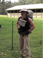
Chapter 2: Preparation My desires to backpack the entire summit of the Koolau Mountains could be manifested in a variety of ways. I decided early on that I did not want stash food and water and attempting to make the entire trip fully self-contained. This would mean collecting water only from natural sources only the trail and carrying 9 days of food from day 1. In order to make this possible I had to: 1) Learn all of my water sources along the trail and my water consumption needs; 2) Learn to reduce my pack weight and bulk to allow for the food; 3) Learn how to make meals that required little water and little bulk that provided enough calories to keep me going.  Conversion of a typical backpacker to an ultra light weight backpacker When I first began backpacking in 2008, I went out and purchased every bit of conceivable gear one could think of for a trip. Solar powered battery chargers, collapsible sinks, and a stainless steel trowel are just some of the many absurdities

Koolau Summit Trail 8-day thru hike by Chase Norton--Chapter 1, The Motivation

Image
Chase Norton   Warning and Disclaimer:   This trip has been put together from years of solo backpacking trips on the summit of the Koolau Mountains. I do not encourage anyone to repeat this hike as the dangers and risk level are very high. I am providing a very detailed account of my trip, but do not take it as a guide. Information on water locations, cabins, weather and trail conditions can all change in the blink of an eye. The gear list provided is what I have learned to work for me in the environment I enjoy backpacking in. As you will read, it has taken me years to learn how to get to a sub 10lb pack while maintain comfort, functionally and safety. This list represents a philosophy and mindset that one must understand in order to best use this gear. Also, most all the gear listed has been modified after purchase or been custom built for my needs. You must have a complete understanding of the hiking environment and conditions for which your gear will be used in. All times and miles

Koolau Summit Trail (KST) rescue

 Hiker Mike Bowen's survival skills were tested to the limit — he drank sweat wrung from his clothes — when poor weather and visibility turned a five-day hike into seven on the Koolau Summit Trail. "Conditions were so harsh, I was not sleeping nights for the most part," said the 30-year-old Kalihi man. "Dealing with the heavy winds and the cold made things very hard. Each night just wore on me." Carrying a 100-pound backpack, Bowen and his little dog, Marley, set out on the Laie Falls Trail at 7 a.m. March 13 and planned to return Sunday, but low clouds, torrential rain, 50 mph winds, knee-deep mud and the loss of his tent posed challenges, including getting lost when he couldn't find an exit trail at the Kua­loa end. Bowen kept in contact with friend Scott Wong by texting on his cellphone, provi

Kulepeamoa Windward (aka The Big Nasty) by Pete Clines

Image
I never thought I saw any windward ridges between Puu O Kona and Lanipo that looked climbable….but I WANTED there to be one. So to force the issue, Chenay, August, and I went on a scout trip to Waimanalo last weekend for some sight-seeing. Most of what we saw was utterly horrible, as evidenced below. Vertical ridges tightly packed together, with majorly rotten rock throughout. While hopefully observing each ridge, a group of church-goers stopped to talk with us. Upon learning why we were staring at the mountains, one of them mentioned that some “professionals” had tried unsuccessfully to climb some of those ridges in the past. Not sure what makes a “professional” but the challenge was definitely on. We agreed it would be another “dragon-slaying” adventure. (Back-story: dragons live in dangerous, remote areas like this and guard against intruders. Completing the adventure means slaying the dragon. Got it?) While almost all of these ridges were quickly dismissed as suicidal, one

Bowman Windward -- Pete Clines

Image
For years I have driven the Likelike Hwy and stared up at the jagged ridges on the windward side of the Wilson tunnel and wondered if they were climbable. Turns out (at least) one of them is. During a recent decent of “Bowman East” with August, Duc, and Laredo… I had time to study those windward ridges from above and later from more of a side angle. Coupled with observations made from Hoomaluhia below, I picked out a route that had potential. So on the last day of 2011 I set off with Chenay to check it out. We started from a neighborhood in Kaneohe around 9:30 – late start since the plan was only to “scout” it. With two major obstacles (H3 and Likelike) between us and the ridge, even the approach required some pre-planning. But a few looks at the topo maps and some common sense in regards to drainage meant we would avoid becoming roadkill. With obstacles 1 & 2 behind us, the task was to find the ridge I had in mind. Looking up, I was reminded of why it was important not

Kalena, Ka'ala, Kamaohanui -- Jeremy Kreis

Image
Probably the first time the traverse from Kolekole Pass to Pu'u Kalena to Mauna Ka'ala to Kamaohanui to Waialua has been done.  The doers were Jeremy Kreis, Matt Church (left, below), and Jonathan O'Hagan (right, below).  The deed was done in July 2011.  Here is Jeremy's summation of the outing, along with some pics he took. Connected the three highest peaks on the island. Original plan was to follow Ka'ala East to Kamaohanui, and then go down Kalena. We had access problems so we started at Kalena instead. Got lost in the Ka'ala Bog so we had to climb a tree to find the FAA Installation. The descent down to Kamaohanui was not what I expected. There is a fence about halfway down, and the climb to Kamaohanui was not very exciting. At the summit, we were debating about where to go down, and, unfortunately, Ka'ala East did not happen. That jagged ridge will have to wait. We followed a fenced ridge down to Waialua instead. Came out on Farrington Highway

Kaau Crater Windward -- Pete Clines

Image
This was another one of those “Nate-inspired” adventures.  Back in April (2011) he shared with us an archived account of a group of HTMCers from the early days (1911) descending into Maunawillifrom the top of Kaau Crater.  They reportedly went top-down using ropes, and endured several scares and injuries along the way.  Nate found reports of a couple more descents, but no ascents.  We (me, August, Duc) were game to check it out.  Using a VERY old hand-drawn map that Nate provided, along with careful studying of the topo maps, I had an idea for which ridge it might be.  However, being so obscure and not standing out from its neighbor ridges, we would need great visibility (no clouds on the summit) to guide in on the powerline towers that conveniently mark the summit.  But getting there would prove more difficult then we imaged.  As it happens, a dragon lives on this ridge and fiercely guards against visitors.  See photo below.   Back-story : The “dragon thing” originated during fatig