Posts

Pali Notches to Piliwale -- Pete Clines

Image
Hike date : 23 January 2011. In January of 2003 I climbed up to Konahuanui from the Pali Lookout by way of the “Notches” ridge. My climbing buddy back then, Brian, was naïve enough to join me. Except for a tense moment when a handhold-rock busted loose on Brian while in a crucial spot over a death drop…. we had a fantastic time with lots of excitement and killer views on a cloud-free day. We exited via the seldom traveled (overgrown) Lulumahu Ridge and looped back to the Lookout.   This past Sunday – almost exactly eight years later – I got Laredo (Murray) and Duc (Ong) to join me for another round of adrenaline. This would be their first time on this ridge. We met at the Lookout and began for the Notches at 8:30 or so. Below is a map of the route, with the orange dash marking the hardest part. This picture was taken from the summit of Lanihuli East – the equally nasty ridge across the valley. We got to the ridgeline in no time, and were treated to a blast of wind. W
Backpack to Wailau Valley, Molokai -- Ted Kanemitsu (2017)

Image

Ascent of Kawaikini (Waialeale)--Lou Hibbard (2017)

Image
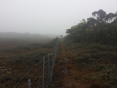
I did this as part of family vacation- they stayed on Oahu. I dayhiked Kawaikini. I drove to Mohihi Trailhead in fading light - gravel road all in the dark and an adventure. It was odd to have this marginal road with the fancy bridges and yield signs. I slept in truck and started hiking at 5:19 AM. It was cool to have so much ridgetop hiking in early section. The river crossing involved a skip across boulders. I would have went later in trip but weather looked good now. I had never bothered with using a GPS track before - this time I tried but data truncated. I have an old GPS. I only had data to near the creek crossing. I never had used Tracbac before except a neighborhood try 2 days before - that was interesting. The trail was overgrown in places but still could be followed. I only lost it twice momentarily on the way back. I hadn't memorized all the old trip reports I looked at as good as I thought so the fenceline was confusing. Ribbons ran out after cone so bac

An Ascent of Pu'u Kukui -- Burton A. Falk (1978)

Image
Early on in my long fascination with Maui I became intrigued with the idea of climbing 5;788' Puu Kukui (lit., "candlenut hill"), rising just east of Lahaina, the high point of the West Maul Mountains. Doing a little research, I found that this peak--because of its almost permanent cloud cap-is one of the wettest spots on earth. The mountain, in fact, has an average rainfall of 40 feet/year, and often competes with Kauai's Mt. Waialeale as the soggiest spot on the planet. Read more...

Kawiwiunu (Puu Kawiwi to Kamaileunu) -- Pete Clines (2011)

Image
Finally got to do the crossover between Kawiwi and Kamaileunu! I have been interested in this route since hearing that Al Miller did it years (and years) ago. I was supposed to take some of the gang up there back in January, but I got sick and spent that weekend in bed. Then the weather was just uncooperative all the recent Sundays. But this past weekend we had the trades back and the forecast was for less rain, so we (Kevin, Duc, August, and I) went for it. Below is the route starting from the usual trailhead in Waianae Valley. The blue arrow marks the notch which is where it gets particularly exciting. After leaving my car near the Kamaileunu trailhead, we rode in Duc’s car to our starting point, and set off up the paved road at 8:30ish. The road was wet and slick - not a good sign as we would prefer dry conditions for a safe climb up and across. From the curve in the road we ducked into the forest on the path to the base of Kawiwi. Most of my ribbons from last year were g

Olomana 3rd Peak (Ahiki) backside

Image
http://www.youtube.com/watch?v=6Feq7JBQa8c

Ascent of Kawaikini on 2017-06-28

Image
View of Poipu from Kawaikini Hikers : Greg Slayden, Laura Newman, Shannon Dilmore, Peter Barr Ascent Trip Report Useful Info: As recently as 2006, the trek to Kawaikini’s summit took up to five tough days of intense jungle bushwhacking through soggy swamps and impenetrable brush. However, over the past decade the access situation here has improved dramatically, mainly due to the construction of pig-control fences. At this point, the trip to this peak no longer involves any bushwhacking and is mainly a trail hike. To be sure, it remains a very rough, rugged, and difficult hike of 23 miles round-trip, and the rainy climate can cause issues with stream crossings and deep mud. But a dry-weather climb by hikers with a 4x4 for trailhead access can be a relatively easy two-day backpack trip. From the Kokee State Park lodge and museum area, a dirt road across Route 550 signed “YWCA Camp” leads east towards the Alakai swamp. This road leads 6 miles to its end, and in most cond